Nature
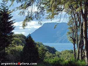
Ecology
National Parks
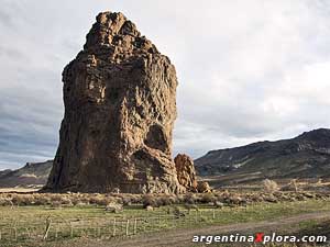
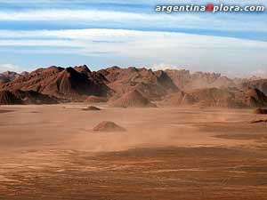
Geography
Archeology
Paleontology
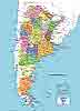
Geography of Argentina
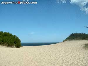
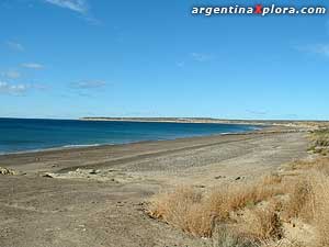
Beaches
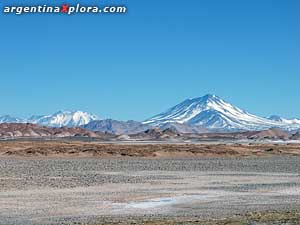
Volcanoes
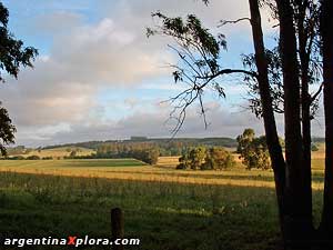
Estancias
Health / Spa / Thermal
Argentina Facts and Features
3,761,274 Km².
2,791,810 km² of American Continent
969,464 km ² of the Antarctic Continent that include Islas Malvinas, Georgias, Sandwich del Sur Islands and a sector of Antarctica
Territorial Extension:
N-S 3.799 Km., W-E 1.423 Km.
Fishing
Ski
Mountaneering
Trekking
Rafting / Kayak
Rugby
Golf
Soccer / Football
4 x 4 Voyages
Polo
Arts & Culture
Legacy & Tradition
Food / Restaurants
Crafts
Endpoints:
North: The confluence of the rivers Grande de San Juan and Mojinete, in the Province of Jujuy, Mina Pirquitas point.
South: Cabo San Pio, located in the Isla Grande de Tierra del Fuego.
East: point located northeast of the town of Bernardo de Irigoyen, in the Province of Misiones, Bernardo de Irigoyen point.
West: point located in the Los Glaciares National Park - Province of Santa Cruz, El Calafate point.
Limits:
North: Paraguay and Bolivia. Southern Chile and South Atlantic Ocean. East: Brazil, Uruguay and South Atlantic Ocean. West: Chile
City Life
Tango
Entertainment
Products / Business
FIND HOTELS
in Argentina
Political Division:
The territory is composed of 23 provinces, the Federal Capital (Ciudad Autónoma de Buenos Ares), Antarctic Continent (including the South Orcadas Islands) and southern islands (Georgia del Sur and Sandwich del Sur).
Population:
40 million inhabitants (estimated in 2.010)
Form of government:
Federal Republic with a bicameral legislative power. It was declared independent from Spain on July 9th 1.816
Main Cities
Ciudad Autónoma de Buenos Aires, 3.058.309 h. Córdoba, 1.329.604 h. Rosario, 1.193.605 h. Mendoza, 880.000 h. La Plata, 654.324 h.
Official Language
Spanish. Some minorities speak quechua and other native tongues
Ethnic Composition
European background 85%, others 15%
Official Religion
Roman Catholic
There is a portion of the population that practices other religions, such as Evangelic, Protestant, Islamic, a large Jewish community, and lately some Afro-Caribbean religions coming from Brazil.
Weather
Argentina has a temperate climate, but the North has a large subtropical zone and southward cold weather prevails.
Buenos Aires, the capital city, has a moderate and humid climate. In winter it is cool, 4° to 10° Celsius
During the night frost is common and during the early hours of the morning fog can occur, diminishing the visibility and you should be alert on roads.
Summer is warm, with an average of 28°C. We recommend light clothing and comfortable shoes.
For spring and fall we recommend you carry a light coat for the morning and evening. Temperatures vary from 12°C to 20°C.
Buenos Aires is mainly humid. Summers are warm (28°C average) and winters are mild (3°C to 8°C average)
|
Longer Rivers |
Km.
|
Sq Mts/Sec
|
Highest Mountains |
Meters / sea level | |
| • Paraná • Uruguay • Negro • Bermejo - Teuco • Pilcomayo • Colorado • Salado (Buenos Aires) • San Juan • Mendoza • Chubut • Salado del Norte • Bermejo / Desaguadero / Salado |
1.800
1.100 635 1.000 850 860 700 500 400 810 2.000 1.200 |
16.806
5.026 865 339 152 134 88 56 50 48 15 14 |
• Aconcagua (Mendoza) • Pissis (Catamarca/La Rioja) • Ojos del Salado (Catamarca) • Mercedario (San Juan) • Bonete (La Rioja) • Tres Cruces (Catamarca) • Llullaillaco. (Salta) • Nacimiento (Catamarca) • Incahuasi (Catamarca) • Tupungato (Mendoza) • El Muerto ( (Catamarca) • Bayo (Catamarca) • Antofalla (Catamarca) • Libertador San Martín (Salta) • El Cóndor (Catamarca) |
22,837 ft /6.960 m
6.882 m 6.879 m 6.770 m 6.759 m 6.749 m 6.739 m 6.658 m 6.638 m 6.635 m 6.488 m 6.436 m 6.409 m 6.380 m 6.373 m |
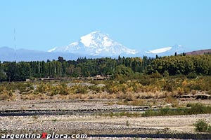
The tallest peak in all of the Americas.
| Lakes | Location |
Area (km²) |
|
Laguna Mar Chiquita |
Córdoba y |
6000 km² |
|
Lago Argentino |
Santa Cruz |
1466 km² |
|
Lago Viedma |
Santa Cruz |
1088 km² |
|
Lago Buenos Aires |
Santa Cruz / Chile |
971,8 km² |
|
Lago Colhué Huapi |
Chubut |
810 km² |
|
Laguna de Llancanelo |
Mendoza |
650 km² |
|
Lago Nahuel Huapi |
Río Negro-Neuquén |
557 km² |
|
Lago Fagnano |
Tierra del Fuego / Chile |
551,3 km² |
|
Lago O'Higgins / San Martín |
Santa Cruz / Chile |
504 km² |
|
Lago Cardiel |
Santa Cruz |
458 km² |
|
Lago Musters |
Chubut |
434 km² |
|
Lago Cochrane / /Pueyrredón |
Santa Cruz / Chile |
145 km² |
|
Lago Strobel |
Santa Cruz |
120 km² |
|
Lago Huechulaufquen |
Neuquén |
84 km² |
|
Lago Fontana |
Chubut |
79 km² |
|
Lago Traful |
Neuquén |
70 km² |
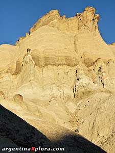
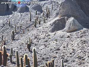
Calingasta, San Juan
About Argentina
The name Argentina comes from the Latin word Argentum, meaning silver. This name goes back to the Spanish Conquerors that were in this region in 1524.
In this territory you will see mountains, plains and mesetas
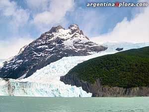
In this country you will find not only the highest peak in America (Aconcagua 6 959 mts) and the widest river in the world (Rio de la Plata 220 km at its mouth)
Mar del Plata. Buenos. Aires.
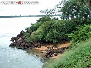
with River San Juan
2000 - 2025
Todos los derechos reservados